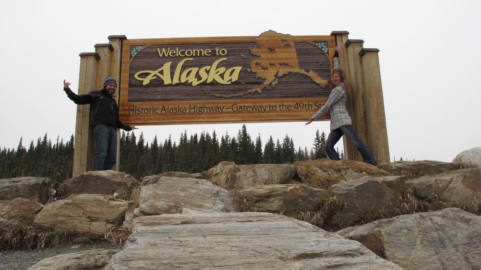
We started the drive in Whitefish, six days and 2181 miles ago. A close approximation, of course, as we didn't turn on the odometer until Eureka, MT and have probably added a few miles looking for gas and whipping u-turns to photograph bears. Today we arrived at our 6th stop, Tok, Alaska, at about four in the afternoon, Alaska time (which happens to be one hour before Pacific Time). Though we still have two days of driving to our destination, Denali National Park, the sense of ease that came with our entering the state of Alaska cannot be ignored. After almost a week of driving through Canada, through ever-changing landscapes and weather systems, we have entered the largest state in the Union.
We began last Friday, a little later than planned due to some revelrous activities the night before with good Glacier friends. Sad to part with those we have come to know so well, but also thoroughly excited about bigger mountains, bigger animals, and well, bigger jobs, we left on good terms with Whitefish, Montana, and hope to see her in the future. The first day we only drove about five hours, crossing the border at the Port of Roosville and camping for the night in Golden, British Columbia. Just west of Yoho National Park, Golden was a sleepy little town, that definitely blows up with tourism during the summer months. Right now, as in every place we have stayed, Golden was at the bare bones, just setting up for the season and collecting only the very early travelers like ourselves. After a dinner of lentil stew with sausages we curled up in our tent, situated just beside a river leading into a canyon. Though train tracks bordered the opposite side of the river, we have become so used to the bumping and clanging of the train cars through our winter in Whitefish that we didn't even notice.

Kurt's beautiful rice bowls proved extremely useful on the journey
Saturday we set out to explore Yoho, the Columbia Icefields, and Jasper National Park. The last time we had been to the Canadian Rockies was the summer of 2009, when Ben and I had first started dating. It was our first international adventure, and Ben's first trip abroad. Needless to say, we were both really excited to see the parks in their winter glory. Though it was still very snowy, especially around the Icefield, the weather outside was gorgeous and warm. Driving the road we passed loads of parked cars, mostly Canadian folks out backcountry skiing for the weekend, making me wish I didn't have a broken hand and wish we had brought our skis with! As I can't describe the beauty of these parks with words, I will let the pictures tell all.
(above) Huge glacier in the middle!

We camped in Jasper Saturday night at a full campground, and actually ended up sharing our site with some latecomer Canadian boys fresh out of exams for the year. The campsite was the only winter/ offseason camping in Jasper, and as it was the first beautiful weekend of the spring, it was filled with RVs and tenters alike. Sunday they took over our site as we bid them adieu and headed still northward toward Grande Prairie, Alberta. There we crossed again into British Columbia, and stayed the night at a little family-owned RV park at Charlie Lake. The RV park had a host of grassy spots, wifi, and hot showers- and it was fabulous. Only about an hour after we arrived, a couple from Minnesota pulled up to camp next to us. Jared and Katie were also driving up to work in Denali, not at our properties, but at a large restaurant in the area. For the next three days we would criss-cross paths, staying at the same campgrounds, and gradually getting to know that they were fun, nomadic folks like ourselves.
While at Charlie Lake we commented on how we had hardly seen any wildlife yet on the trip, and attributed it to the time of year. That night, I was awoken out of my slumber by loud footsteps outside the tent. Waking in the middle of the night always causes irrational thought, and I had a brief vision akin to the scene in 'A Christmas Story' where masked bandits jump over the fence to raid Ralphie's house. Shaking my head and convincing myself that it wasn't bandits stealing things out of our car, I listened closer and heard... chomping. And munching. It sounded like a large ruminant. It was a moose. Or more than one moose. Horrified, I didn't move and tried to make myself go back to sleep. I thought I felt one brush the tent. I find moose to be the most horrifying animals I've ever encountered, aside from hippos. Both large, cumbersome creatures, they are aggravated randomly, and strike with the vengence of a small army. Hilariously enough, curled in my tent, I remembered our experience camping at Lake Baringo in Kenya where night-roaming hippos chomping on grass woke me up. Even more coincidentally, Ben woke up both the hippo night and the moose night with an unignorable urge to use the bathroom. Though hippos were enough to force him to forget the urge, he wasn't as scared of moose and proceeded without any trampling occurances.

Not the moose outside our tent...but a moose nonetheless
The next two days of driving blew by as a whir of trees, plains, trees, plains, mountains. Northern British Columbia is somewhat monotonous and akin to the Northern Plains at points. Towards the end of our driving on Monday, however, it began to get hillier and more interesting, but also colder. We had one thing driving us, however. Hot springs. We read about the Liard Hot Springs the day before, and were dead set on checking out the campground-cum-hotsprings that was the 'one thing to absolutely see on the Alaska Highway'. We arrived in the late afternoon, and immediately set out for the hot springs after setting up our tent. OH it was fabulous. It was the hot springs of my dreams. I have been to quite a few hot springs in my life, and there seems to be two types: 1) large, warm concrete pools resembling nothing but a communal bath without the chlorine, or 2) slimy rocks in some hot water. I am more a fan of the slimy, if I had to choose, but the Liard Hot Springs changed my mind forever. It was a minimally developed natural spring in the forest with a large deck and gravelly bottom. No slimy rocks, but beautiful surrounds. Even more amazing was the relative changes in temperature- you could position yourself close to the spring for the scalding hot, but the further you went downriver, the cooler it got. Even more awesome, was that approximately 8 other people at the campsite were all heading to work in Alaska/Denali as well. One huge, crazy caravan.

Drying my bathing suit
The river pool
The actual spring and hanging gardens
Hard to top the hot springs, I didn't want to leave. I had spent a medicinal hour in the hot tubs soaking my mending hand, and it felt soooo good. Nonetheless, we headed out in the morning and covered the remainder of the Alaska Highway in British Columbia until we hit Watson Lake, Yukon Territory. The Yukon is big. Everything about it is huge, which makes it apt that Watson Lake, the first town over the border would be home to the world's largest signpost forest. What is a signpost forest, you ask? Well, some road construction worker in the 1940's was homesick for the lower 48 and decided to start collecting signposts, and each year it grows by about 2,000 signs- making the collection over 70,000 current signs! We added our front license plate, of course.
our plate!
my personal favorite sign
note: yield for camels sign in far back
After the signpost forest, there wasn't much to be seen until the town of Whitehorse, where we stopped for the night. As we drove through rain and snow all day, we pondered the idea of staying in a hotel, and when we heard that the forecast for the night was in the teens, we decided for sure. We stopped at the visitors center in Whitehorse, where we ran into Jared and Katie again. Together we determined that Canada's Best Value Inn was indeed Canada's best value at a whopping $100/night. A little bit weather worn, and in a sketchier part of town (a local on the street told Katie that she was staying on 'skid row'), the Best Value turned out to be decent enough for what it was. Perhaps the most interesting part was the evening front desk worker, Ron. A Montreal-er by birth, a BC-er by life, and a Yukon-er in retirement, he is also a wildlife and landscape photographer who just loves what he does. Ron's goal in the next year is to actually stop working, buy an RV, and come up to Alaska himself (you can find him on Flickr- The Yukoner).
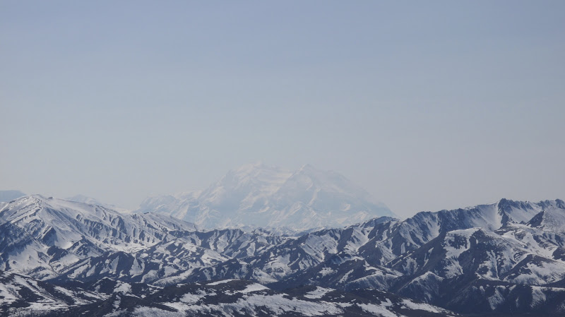
This brings us to today. Another day of driving, starting with a rather bumpy 200-mile stretch to the Alaska border, and ending here in Tok. That being said, it was not really that bad. For the amount of warning we got about the Alaska Highway- "Bring at least a 5-gallon gas can!" "You should definitely have a couple extra tires"- the entire highway has been a gem. Even today, with shallow dips and crests giving the sensation of a childrens roller coaster ride, it was nothing compared to a lot of the roads in the Chicago-land area. So know now, the Alaska Highway is not the Al-Can of yesteryear! There have been major improvements in the past 20 years- i.e. it is a normal highway. We skirted the ouside of Kluane National Park in the Yukon, the vast landscape of Lake Kluane giving way to mountain range upon mountain range. No one lives there. We saw decrepit businesses, of poor souls thinking they could make it selling gasoline, only to find themselves out of business in who knows how long. It was a beautiful but desolate landscape, that seemingly changed when we crossed the American border. It was strange, but the moment we crossed, not only did we cross to freshly paved highway, but we crossed into snowy mountain passes, sunnying skies and the mountains of Wrangell-St. Elias National Park. Though the clouds were low, the mountains looming on the horizon are the biggest ones we've seen yet. And at that, I will leave with some photos of the day.


Lake Kluane